Lowrance LMS-522C iGPS Operation Instructions
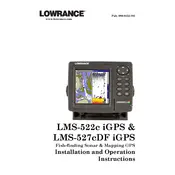
Lowrance LMS-522C iGPS Fish Finder manual cover
Pages 252
Year 2006
Language(s)
English en

Lowrance LMS-522C iGPS Fish Finder Specification

The Lowrance LMS-522C iGPS Fish Finder is a sophisticated marine navigation and fish-finding device designed to enhance the fishing experience with its advanced technology. It features a high-resolution 5-inch, 256-color TFT display that provides clear and vibrant visuals, ensuring excellent visibility under various lighting conditions. The device is equipped with a built-in precision GPS+WAAS antenna, offering accurate and reliable navigation capabilities essential for both amateur and professional anglers. The fish finder utilizes a 200 kHz sonar frequency, delivering detailed underwater imagery and depth readings to effectively identify fish and underwater structures.

The LMS-522C iGPS incorporates Lowrance's advanced sonar technology, allowing users to access real-time sonar updates, including fish arches and bottom contours. It supports split-screen viewing, enabling simultaneous display of sonar and GPS mapping for comprehensive situational awareness. The device includes a 30 GB internal hard drive preloaded with detailed U.S. maps, covering lakes, rivers, and coastal areas, enhancing its navigation functionality. Users can further expand its mapping capabilities through the compatible MMC/SD card slot for additional map downloads and updates.

Durability is ensured with its rugged, waterproof design, suitable for various marine environments. The user interface is intuitive, providing quick access to features and settings, accommodating both novice and seasoned users. Additionally, the LMS-522C iGPS supports NMEA 2000 networking, allowing seamless integration with other marine electronics for enhanced data sharing and system functionality. With its combination of high-performance sonar, precise GPS navigation, and user-friendly operation, the Lowrance LMS-522C iGPS Fish Finder stands as a reliable tool for maximizing fishing efficiency and safety on the water.

Lowrance LMS-522C iGPS Fish Finder F.A.Q.

How do I update the software on my Lowrance LMS-522C iGPS Fish Finder?

To update the software, download the latest update files from the Lowrance website onto an SD card. Insert the SD card into the unit and follow the on-screen instructions to complete the update process.

Why is my Lowrance LMS-522C not turning on?

Check if the battery is fully charged and ensure all power connections are secure. If the problem persists, inspect the fuse and replace it if necessary.

How can I reset my LMS-522C to factory settings?

Press the MENU button twice to access the main menu, select SYSTEM SETUP, and then select RESET OPTIONS. Choose RESET ALL SETTINGS to restore the factory defaults.

What should I do if the GPS is not acquiring a signal?

Ensure the GPS antenna is unobstructed and positioned correctly. Check for any software updates that might improve GPS performance. If issues continue, consult technical support.

How do I interpret the sonar readings on my LMS-522C?

The sonar returns are displayed as arches or lines on the screen. Larger arches typically represent larger fish. Use the manual to understand different sonar settings and optimize readings.

Can I use my LMS-522C in saltwater environments?

Yes, the LMS-522C is suitable for both freshwater and saltwater. However, rinse the transducer and unit with fresh water after use in saltwater to prevent corrosion.

How do I perform regular maintenance on my fish finder?

Regularly check all cables and connections for wear or corrosion. Clean the screen with a soft, damp cloth and ensure the transducer is free of debris.

What is the best way to mount the transducer for optimal performance?

Mount the transducer on the transom of the boat, ensuring it is parallel to the waterline. Avoid placing it near any obstacles that could cause turbulence.

How can I troubleshoot depth reading inaccuracies?

Ensure the transducer is properly mounted and free from obstructions. Verify that the correct frequency is selected for the water conditions. Adjust sensitivity settings if needed.

What are the steps to save waypoints on the LMS-522C?

To save a waypoint, press the WPT button on the unit. Enter the desired coordinates or mark the current location, then save the waypoint with an identifiable name.