Bushnell BackTrack D-TOUR 360310BG Instruction Manual
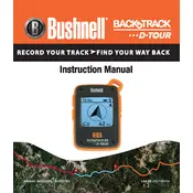
Bushnell BackTrack D-TOUR 360310BG GPS manual cover
Pages 60
Year 2014
Language(s)
German de
English en
French fr
Italian it
Spanish sp

Bushnell BackTrack D-TOUR 360310BG GPS Specification

The Bushnell BackTrack D-TOUR 360310BG GPS is a compact and user-friendly GPS navigation device designed to provide essential tracking and location features for outdoor enthusiasts. It is built with a focus on simplicity and reliability, ensuring users can navigate with confidence in various environments. The device features a high-sensitivity GPS receiver that allows for accurate tracking and positioning, even in challenging terrains.

The BackTrack D-TOUR supports up to five location storage points, enabling users to mark key waypoints and easily navigate back to them. It is equipped with a digital compass that assists in accurate direction finding, and it displays essential data such as latitude, longitude, altitude, and time. This GPS unit also includes a trip computer that provides valuable insights into current speed, total distance traveled, and average speed.

One of the standout features of the Bushnell BackTrack D-TOUR is its ability to record up to 48 hours of trip data. Users can easily transfer this information to their computers using the included USB interface, allowing for detailed trip analysis and sharing. The device operates on two AAA batteries, providing a convenient power solution for extended outdoor adventures.

The BackTrack D-TOUR is designed with a rugged and weather-resistant housing, ensuring durability in various weather conditions. It features a simple interface with a backlit LCD display, making it easy to read in low-light conditions. Compact and lightweight, the device is highly portable, making it an ideal companion for hiking, camping, and other outdoor activities where reliable navigation is essential. Overall, the Bushnell BackTrack D-TOUR 360310BG GPS is a practical tool for those seeking straightforward navigation assistance without the complexity of more advanced GPS devices.

Bushnell BackTrack D-TOUR 360310BG GPS F.A.Q.

How do I calibrate the compass on my Bushnell BackTrack D-TOUR 360310BG GPS?

To calibrate the compass, hold the device level and rotate it in a figure-eight motion until the calibration notification disappears. This should be done in an open area away from large metal objects.

What should I do if my GPS device is not acquiring a satellite signal?

Ensure you are outdoors with a clear view of the sky. Avoid obstructions such as tall buildings or dense trees. Restart the device and wait a few minutes for it to acquire a signal.

How can I reset my Bushnell BackTrack D-TOUR GPS to factory settings?

To reset the device, press and hold the power button for about 10 seconds until the screen goes blank. Release and restart the device to complete the reset process.

Why is my GPS device turning off unexpectedly?

Check the battery level and replace the batteries if necessary. Ensure the battery compartment is clean and the contacts are not corroded. If the issue persists, contact customer support.

How do I update the firmware on my Bushnell BackTrack D-TOUR GPS?

Visit the Bushnell website and download the latest firmware update. Connect the device to your computer via USB and follow the instructions provided with the firmware download.

What maintenance steps should I take to ensure my GPS device remains functional?

Regularly check and replace the batteries, clean the device with a soft cloth, and store it in a dry, cool place. Avoid exposing the device to extreme temperatures or moisture.

How do I save a route on my Bushnell BackTrack D-TOUR GPS?

To save a route, use the 'Mark' button to save waypoints as you travel. The device will automatically record the route, which you can view later in the device’s memory.

Can I use my GPS device while hiking in remote areas?

Yes, the Bushnell BackTrack D-TOUR is designed for outdoor use and can track your route and location in remote areas, provided there is a clear view of the sky for satellite connectivity.

How can I transfer my recorded routes to a computer?

Connect the device to your computer using a USB cable. Use compatible software to download and view your recorded routes in formats like GPX or KML.

What do I do if the screen display is not clear or is malfunctioning?

Check for any screen protectors that might have air bubbles and ensure the screen is clean. If the problem persists, perform a reset or contact customer support for further assistance.